
Inky Maps! Illustrate a Beautiful Map Using Digital and Analog Media
Tom Froese · Illustrator and Designer
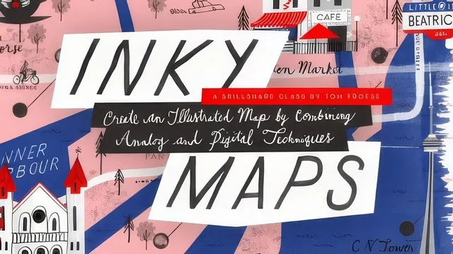
A solid second-course map-illustration project that assumes you already know Photoshop basics from Tom Froese's earlier class.
A Sequel Project, Not a Standalone Lesson
Tom Froese pitches this class explicitly as a follow-on to his earlier Inky Illustrations course, and the structure bears that out. The equipment lesson states outright that Photoshop Elements will not work because the project depends on layers and the Pen tool, and that anyone new to Photoshop should go back and take the prerequisite first. That is an honest framing rather than a hedge. The map project genuinely does layer analog ink work over a fairly technical digital compositing process, and viewers who arrive without a working knowledge of paths, clipping masks, and smart objects will spend more time fighting the software than learning to draw maps.
The course opens with a clear conceptual scaffold: five elements every illustrated map needs (geography, roads, icons, labels, a compass rose), which then functions as a running checklist through the rest of the class. That framework is the strongest piece of instructional design here, because it gives an otherwise loose, expressive medium a concrete structure a beginner can check their own work against.
From Brainstorm to Base Map
The brainstorming lesson is more useful than it first appears. Rather than just saying "pick a city," Froese walks through narrowing a broad idea (his hometown, a few favorite cities) down to a specific personal angle, landing on "Toronto in my twenties" and building a list of eight meaningful locations from that lens. It is a small but real lesson in scoping a creative project, applicable well beyond map-making.
The technique for building the base map is the class's genuine standout. Rather than starting from a blank page, the course has students plot their points of interest in a custom Google Maps route, screen-grab that view, paste it into Photoshop, and then aggressively stretch and skew it with the Transform tool until the roads read as a usable, if geographically loose, sketch base. Froese is upfront that this sacrifices real-world accuracy for storytelling clarity, which is the right trade-off for the assignment and worth stating plainly rather than leaving implicit.
Where the Craft Lives, and Where It Thins Out
The inking and compositing lessons are dense with hands-on detail: nib and brush choices, working from a light table, hand-inking repeatable elements like railroad hashes once and reusing them, and building loose ink-wash textures separately from linework. The color lesson is a genuine highlight for anyone unfamiliar with print-map history, using historical two- and four-color map guides to demonstrate how limited palettes and layer overprinting can still read as rich.
Where the course thins out is lettering. It gets promised real weight in the five-elements framework but ends up covered only briefly, mostly as a byproduct of the inking lesson rather than a dedicated skill-building segment. The compositing lessons, meanwhile, occasionally slow into narrated Photoshop mechanics (nudging alpha channel masks, toggling foreground and background colors) that read more like a screen-recording walkthrough than a teaching moment, and non-designers may find themselves rewinding rather than absorbing a transferable principle. Overall this is a well-organized, technique-rich sequel course that rewards patience and prior Photoshop comfort more than it accommodates newcomers to the medium.
The standout
Screen-grabbing a custom Google Maps route as tracing paper, then deliberately stretching and skewing it in Photoshop's Transform tool to fix proportions before sketching, turns an intimidating blank-map problem into a guided drawing exercise.
What you will learn
- A five-part framework for what belongs in an illustrated map: geography, roads, icons, labels, and a compass rose
- How to brainstorm a map concept by narrowing a city down to a personal angle and 5 to 10 points of interest
- How to build a base map by pasting a Google Maps screenshot into Photoshop and stretching or skewing it into a usable sketch layout
- A hybrid analog-digital inking workflow: hand-inked linework with a nib pen and brushes, scanned and composited in Photoshop as smart objects
- How to build a limited color palette from vintage map references and lay down color using pen tool paths and clipping masks
- Layer organization habits (nested groups, alpha channel masks) for keeping a multi-element illustration file manageable
Best for: Someone who already finished Froese's Inky Illustrations class and wants a longer, more structured project to practice combining ink work with Photoshop compositing.
Skip it if: Photoshop beginners, anyone without India ink and nib pens on hand, or anyone hoping for a lettering or typography deep dive rather than a brief aside.